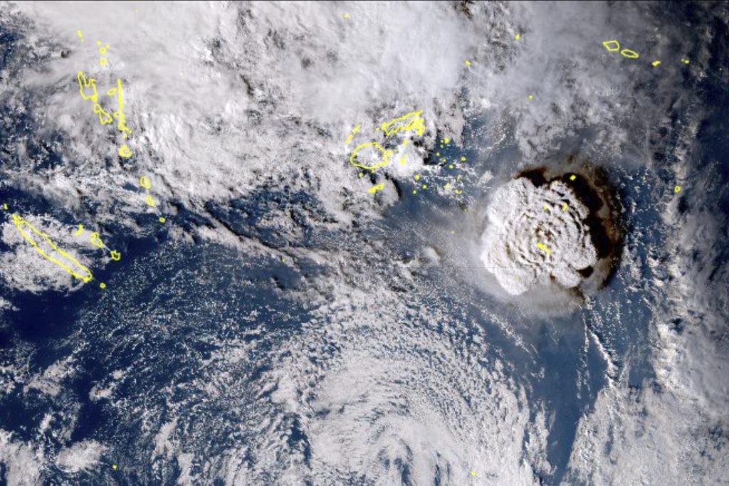
Satellite images collected over a period of 2 hours show the ash and vapors emitted following the volcanic eruption.
Images taken by Himawari 8, Japan’s meteorological satellite.
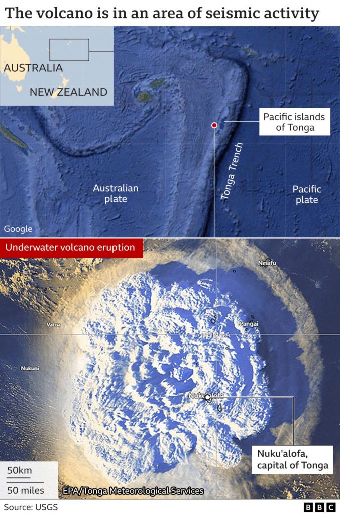
In this satellite image taken by Himawari-8, a Japanese weather satellite, and released by the agency, shows an undersea volcano eruption at the Pacific nation of Tonga Saturday, Jan. 15, 2022. An undersea volcano erupted in spectacular fashion near the Pacific nation of Tonga on Saturday, sending large waves crashing across the shore and people rushing to higher ground. (Japan Meteorology Agency via AP)
The epicenter was reported below the Pacific Ocean floor, however; no tsunami alert was issued.
The V-2 was the world's first long-range guided ballistic missile. The liquid-propellant rocket engine used to launch the missile was developed in Germany as a "defense weapon" during World War II. Essentially, it was a weapon used to attack the...
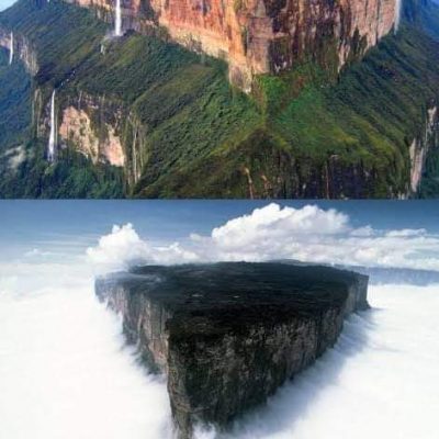
Deadly version of isolation The Amazon world itself has not yet given any hold to man. Is there any place more isolated than that inside? Mount Roraima is a large mountain with a flat top. It is found in North...
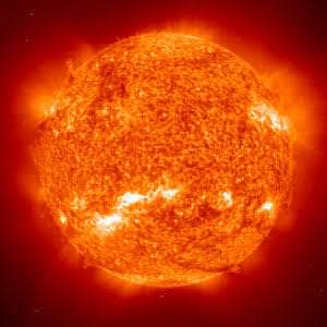
Hens Stephenson 2-18 is the largest star ever discovered.Hens Stephenson 2-18 has 2,150 times the size of our Sun.It is located in the constellation scutum, 18,900 light-years from Earth.

Recent Comments