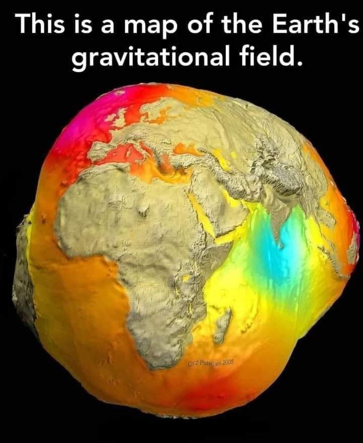
Gravity map is a map of the intensity of the Earth’s gravitational field. How to do it. Simply put.The two satellites orbit the Earth at a distance of over 200 km. It is also linked to other GPS satellites, which transmit microwaves to each other and record continuously.

They record even the smallest displacement (even by one micron) of mass passing through a large area. All of this data analyzes the resulting image and shows the Earth’s gravitational fields. Blue is the least intense area. GRACE are NASA’s twin satellites that helped make this image.

GOCE is owned by the European Space Agency. They are also very useful for knowing the ocean and the flow of the Indian Ocean. As the intensity increases ……
????, ?????, ??????, ??????,


Recent Comments