
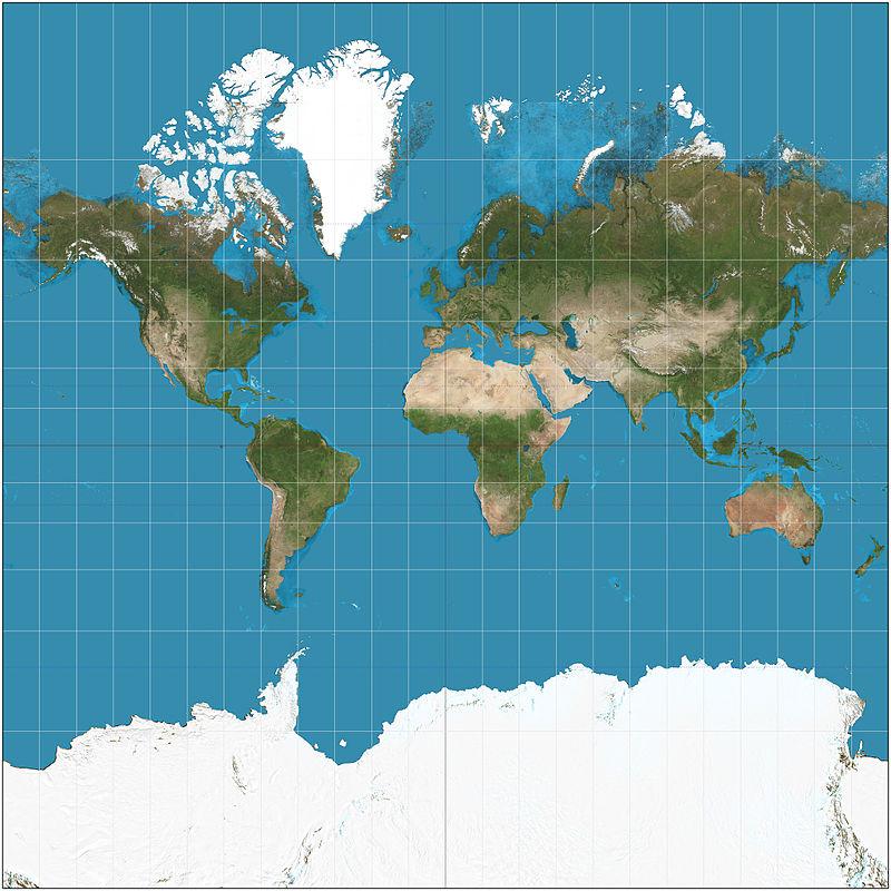
The type of map shown below, or the method of showing the earth as a whole, is called Cylindrical projection. This is the map we usually see. Here, the surface of the earth is wrapped around an imaginary cylinder and then spread out to make it look like a flat earth.
At that time, the latitude and longitude of the poles have to be shown in a flattened, or expanded, manner on this map. Then the place and size of those places.
That’s why Greenland looks like 14 times the size of Africa. Let’s give one more example. Australia in the map below is four times larger than Greenland. This is a problem due to flattening of the round earth.


Recent Comments